One of the first posts I made on this blog in mid 2011 was about real time location services for public transport. At the time, this was limited to an SMS service where you send a message with a bus stop number and receive a response with all buses set to arrive there in the next half hour, achieved by installing GPS devices on buses to track where they are at any given time. There was also the 131500.info trip planner, but it did not provide real time data nor was it the most user friendly system out there. Mobile apps like TripView did provide a better user interface, but did not provide multi modal functionality (so if you had to catch a bus and train then you needed to do 2 separate searches). Meanwhile, the easy to use Google Transit function on Google Maps was limited to trams and the monorail in Sydney.
At the time, I lamented that there was not some more user friendly, perhaps more graphical form of providing this service, and one that provided the actual real time location of your bus/train/ferry/tram rather than just what’s on the timetable. There was little reason why either wasn’t possible at the time, in fact the former had already been achieved by Fink Labs before being shut down by the Transport Department (see image below).
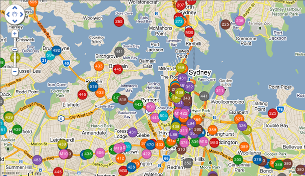
A discontinued real time bus location app. (Source: Fink Labs.)
Thing have changed significantly since then. Google Transit expanded to all modes of transport, while real time data (currently only for for government buses, but hopefully set to be expanded to all buses next year) was introduced to transport apps. So here is a summary of some of the major transport services: 131500, Google Transit, TripView, and TripGo.
Note: One of the mobile apps (Arrivo Sydney) that recently added real time information is Android only, and as an iPhone user I was unable to try it out.
131500
Pros: multi-modal, offers a call center service
Cons: Interface could be easier to use, no real time data
This is the official government transport information service. It was great when it first came out years ago, but has seen little improvement since. In almost every case, you’re better off going with Google Transit. Google’s service is easier to use, has a better display, and everything that Google is missing is also missing from 131500. The one exception is the phone service for those luddites out there, where someone at the call center will let you know the details you need.
Strangely enough, despite this being the government service, it lacks real time data for buses.

Google Transit
Pros: easy to use interface, good for people unfamiliar with transport network, multi-modal
Cons: no real time data
All bus, train, ferry, and light rail timetable data in was incorporated in July of 2012. It provides multi-modal information, so you do not have to do a separate search for a bus trip and a train trip, you just did a single search that gave you the information for both. The user interface is very easy to use, both on a computer or a mobile device, particularly for people who only know the origin and destination, but aren’t sure where nearby bus stops or train stations are or what the best bus route to take is. The main downside is the lack of real time data, and thus does not take into account delays to services (similar to its traffic function, which recommended the fastest way to drive given the road traffic at any particular time and day).

The Google Transit function of Google Maps shows multi-modal trips, in this case a bus followed by a train. Click on image for higher resolution. (Source: Google Maps.)
TripView
Pros: easy to use interface, can use offline, real time bus data
Cons: not multi-modal, need paid version to save trips for later, assumes some knowledge of transport network
Prior to Google Transit, this was arguably the best mobile transport app. A free version is available, with a premium version which allows you to save trips for easy access later on. It now contains real time bus data, and this is displayed in an easy to read format. It is also the only app I’ve seen that allows offline use by downloading all the timetables to your device (handy when you’re in a black spot or out of data).

The new TripView app shows the actual time above and the original timetabled time below, next to a square coloured to indicate whether it is early (blue), on time (green), or late (red).
The real time data can also be displayed in map format, in a similar manner to the Fink Labs app from 2011, but with one important improvement – it now tells you the direction the bus is going.

TripView also includes a map showing the actual location of all the buses that will go from the origin to the destination of your designated trip, indicated by the green line. A triangle indicates which direction the bus is moving in.
The main shortfalls of TripView are that it does not allow multi-modal trips, and you need to know the exact origin and destination of your journey. For example, if you are going from the city to Castle Hill, it won’t tell you whether the best way to get there is to get a direct bus, or to take a train to Parramatta and then change for a bus. You have to work that out yourself. And if a train and bus is the faster option, then you have to do 2 separate searches. Also problematic is that if you tell it that you are going from a specific bus stop, then it won’t consider telling you to walk around the corner to catch a bus from another bus stop, even if that is a quicker option. But if you are familiar with the bus and train network, then that’s less of a problem.
TripGo
Pros: multi-modal, real time data, very informative, includes taxis
Cons: Interface is clumsy
At first, TripGo looks like the poor sibling of TripView. In actuality, it’s something inbetween Google Transit and TripView. Like Google Transit, it provides multi-modal trips (including driving and bicycles), and like TripView it provides real time bus data. In addition, it also has taxis as an option, and allows you to sort the alternatives by cost in dollars, trip length, carbon emissions or first to arrive at destination if you leave now. This also means you don’t need to have an understanding of the transport network. It also makes use of your address book and calendar when setting up your trip.
This app is new, and has some teething problems. For example, it sometimes complains that the origin and destination are too far away, doesn’t factor in the airport station access fee in the cost of getting the train to the airport, or recommends driving to and parking at central station before getting a train from there.

Where it misses the mark is on the user interface, which just feels a bit clumsy. That in itself is enough to keep me from using it on most occassions. Though if I’m making a trip to or from an unfamiliar location for the first time, I’d consider using it just that once to gather my bearing. But after that I’d probably stick to either Google Transit or TripView.

TripView is sort of multi-modal — you can save multiple searches into a single trip (e.g. train from A to B and then a bus from B to C) and then “A to C” becomes a single trip that one need only consult once.
Adrian from TripGo here. Thanks for the review! Always happy about constructive criticism.
FYI: The “locations are too far apart” pops up when you try to do cross-city routing like Sydney to Melbourne which are routing engine doesn’t handle yet due to lack of flights and intercity train data. We are looking into the bug that airport surcharge isn’t correctly applied. Lastly, parking data and suggestions is something we are keen on improving. At the moment we rather give some odd multi-modal results rather than missing other sensible park-and-ride options; it’s a touch balance to nail automatically as you can imagine.
Thanks for the feedback.
The trip that gave me the “locations are too far apart” message was entirely within Sydney’s Eastern Suburbs (Coogee to Little Bay).
As for trips involving parking, Cityrail does provide information on which stations have park and ride facilities. As far as I know, none of the transport apps out there currently incorporate that information.
Always good to see another service for commuters out there. I’m sure you’ll get the kinks and teething issues worked out in due time. I look forward to seeing how it goes!
Have you seen the official Transport Info app? (http://www.131500.com.au/plan-your-trip/Info-on-the-go/transport-info-app). It does include real-time info on buses, supports multi-modal and allows you to select locations (current location, address, etc.) rather making you select a particular transit stop. This makes it the best app for my purposes.
However the problem I have with all the apps is that the actual location data is rubbish! A large percentage of the buses don’t seem to be registered. I regularly see buses come by which haven’t been listed, and then there are sometimes “phantom” buses which are 5 minutes away, 3 minutes away, 1 minute away, then disappear (my guess is that these buses are reporting the wrong bus number). Of course this isn’t the fault of the apps, but until the GPS is working on all buses, and the data is accurately reported, I find the apps to be close to useless.
If you bump into such phantom buses, it’d be helpful if you send send details to the app developers. They can then work with the transport department to figure out what caused the bad data.
[…] seems Google did this on its own, rather than with help from the state government). More recently real time bus data was provided for STA buses, and will hopefully later be extended to all buses and also […]
[…] Real time GPS locations on transport apps […]
So if I have some kind of trick question, like how to get from Roseville to Kellyville, then I am going to be pondering this question some time before I leave, and real-time information about where the buses are “now” is going to be irrelevant and useless.
There are about 6 different ways to get from Roseville to Kellyville, and which one is best, depends on when you are going.
[…] introduction of real time data for transport apps (first for buses, then later for trains) is a definite improvement. Providing passenger information displays (PIDs) […]