27 global cities, rated by transport quality. 27 is the best, 1 is the worst. Click on image for higher resolution. (Source: Cities of Opportunity, PwC, page 16.)
Cities were ranked from 1 to 27, with 27 being the best and 1 being the worst, in 6 different categories. Sydney rates particularly badly when it comes to cost (1), taxis (4), and coverage (7). It gets a more average rating on major construction activity (10), and something called “public transport systems” (17), while doing best on housing (27).
The problem with this report is that the definition of urban areas varies from country to country. In Australia, an urban area includes both the CBD/inner city as well as the suburban sprawl, while in most other countries the urban area includes only the CBD/inner city areas. For example, Greater Sydney has a population of around 4.6 million people in an area of 2,250 square km (Source: Wikipedia), while the San Francisco Bay Area has a population 7.2 million people in an area of 18,000 square km (Source: Wikipedia). But when you look at just the core areas of the cities of San Francisco and Sydney, they have a much smaller population (800,000 and 170,000 respectively) and much smaller area (120 and 25 square km respectively). What the report does it to compare Greater Sydney to the central core of the other global cities.
The problem with including Sydney’s outer suburbs in this calculation is that it distorts the results of the study. The cost was calculated based on “the longest mass transit rail trip within a city’s boundaries” (Cities of Opportunity, PwC, page 57), but without adjusting the cost for the distance. Coverage was calculated based on “the kilometers of mass transit track for every 100 square kilometers of developed and developable land area” (Cities of Opportunity, PwC, page 57), which is going to be much worse when you include all the low density suburban areas which cannot sustain the concentration of public transport which a dense core can. These would be fine if it was comparing like with like, but in the case of Sydney, it is not.
Also perplexing was the decision to measure public transport systems, where the report says cities are “further differentiated by the extent of multi-modal transport systems, including subway, bus/bus rapid transit, taxi, light rail, tram/trolley/streetcar, commuter rail, and bike share systems” (Cities of Opportunity, PwC, page 95). Here the report confuses having multiple transport modes as an ends, rather than a means. The point of having multiple modes of transport (e.g. catching a bus from a low density suburban area to a nearby train station, then changing onto a train into the CBD) is to improve mobility across a city. But the goal is the improved mobility, not the multiple modes of transport. The multi-modal transport system is the means to and end, which in this case is mobility. While it can often be used as a proxy for improved mobility, it could also indicate a poor transport system that duplicates or competes with itself.
Ultimately, most people in Sydney who read the results of this report are likely to agree with it. This is largely due to public transport’s poor image in the public eye, and it’s reports like this which unfortunately add to the poor image problem of Sydney’s transport system, which while in need of improvement, is not as bad as it is often made out to be.
UPDATE (27 October): Just realised that references to PwC were accidentally written out as PcW due to my fat fingers. These errors have now been corrected.
I recently got back from a 3 week holiday from all over the USA (which also explains the lack of activity here of late – my apologies for the lull, but I’ve had a bunch of things to catch up on and this hasn’t been high on my priorities). As it’s my first post since I getting back, I thought I’d write a bit about my encounters with public transport during my travels.
Monorails are quite common. I saw them at a number of airports (Orlando, Atlanta, JFK and San Francisco) as well as both Disneyland and Walt Disney World. I took a video in the Orlando Airport one and included it below. In all these cases (with maybe the exception of Disneyland) they were used as a form of mass transportation, rather than a glorified tourist trap like the Sydney monorail
Wheaton Station on the Washington D.C. Metro has the longest escalator in the Western Hemisphere. I went there to check it out for myself, and took two and a half minutes to get to the top of it. See video below.
Los Angeles really is designed for cars, rather than public transport. The city actually has a good network of cris-crossing lines that can get you from just about anywhere to just about anywhere else, but because the city is so spread out this can take a very long time. Only the poor people who cannot afford their own car use public transport. I drove there for one day, and the freeways seemed quite well designed, operating at full capacity, but with the use of traffic lights on the on ramps to keep them from going over the maximum capacity and leading to traffic jams on the freeway. This leads to localised traffic jams around the city, but keeps them from spreading through to the rest of the city via the freeways.
New York (Manhattan in particular) is very easy to get around on trains, buses and on foot. I wrote a post about it on my travel blog while I was away which I will repost below, and which you can read here.
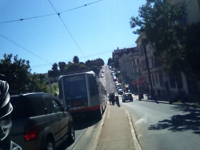
San Francisco has more modes of transport than I have seen anywhere else: heavy rail, light rail, trams, cable cars, trolley buses, buses and ferries. I also wrote about it on my travel blog (here and here), and have again reproduced the relevant portions below.
Above: Wheaton Station escalator.
Above: Orlando Airport monorail.
New York Transport
There’s a lot of transport options in New York, so much so that only something like 25% of Manhattan’s 1.5 million residents own a car. There’s long distance Amtrak trains which will take you to Boston, Philadelphia, Washington DC or pretty much anywhere else in the Northeast United States. Ten there’s commuter rail, like Long Island Rail if you’re going to Long Island (past Queens and Brooklyn) or PATH if you’re going to New Jersey, but I’ve also seen trains that go to nearby Connecticut. All these trains tend to go either to Grand Central Terminal (if the come in from the North) or Penn Station (if the come in from Long Island), with PATH trains just terminating on the Western edge of Manhattan.
On top of that there are also ferries to take you to one of the many islands around here. It’s easy to forget that of New York City’s 5 boroughs – Manhattan, Brooklyn, Queens, The Bronx, and Statten Island – only The Bronx is on mainland America.
Buses are either local or express. Local buses fit in to the subway system, so I’ll talk about them later. Express buses cost $5, which is expensive when compared to a local bus or subway trip at about $2, and I don’t know much more about them than that.
The subway is quite a complicated tangle of lines, but for the most part follows Manhattan’s street grid system. Most lines go North/South along the Avenues. At their Northern ends, the lines either terminate in uptown Manhattan, continue North into The Bronx, or turn East into Queens. On their Southern end, the lines either terminate in downtown Manhattan, or turn East into Brooklyn. All the trains therefore indicate their direction by saying uptown/Queens or downtown/Brooklyn. This is important as some entrances/exits are for only one direction, and if you get it wrong then you must exit and pay to enter on the other end. Here’s one example, you can see which lines serve this station and also the direction in which they go (some entrances will let you enter to either platform, as this one indicates).
There are also a couple of East/West lines, though only 2 of these are East/West the whole way in Manhattan, with the rest spending part of their time in Manhattan traveling North/South. Not only do most subway lines travel along the Avenues, but they have stops on the same Streets. I’ll use my experience as an example.
I’ve spent most of my time in midtown Manhattan, which you can see below.
My hostel is on the corner of 23rd Street and 11th Avenue (middle on the left), which means I have to walk along 23rd Street until I reach 8th Avenue, where I can get on the subway station there. Or, if I want to get on another line, I just keep walking East along 23rd Street until I get to 7th Avenue, 6th Avenue, 5th Avenue or Park Avenue, where there are other stations. And this is where the local buses come into play. Each of these streets with subway stations along it has a bus line running in each direction. So if you want to get anywhere, you catch a bus East/West, then get a train North/South and get to where you’re hoping to get to. It’s that simple.
If you’re going further, then the lines start to deviate, but criss cross in order to allow you to change from one train to another in order to get to where you need to go. The first few times you use it, it’s easy to get lost or disorientated (such as going in the wrong direction or taking an express train instead of a local – all stops – train), but pretty soon it becomes second nature.
Since I’m here for 8 days, I just paid for a 7 day unlimited pass. It cost me $29 and let’s me travel on the subway and local buses as much as I want for a week. Considering I spent $46 for a little over 4 days in Washington DC for transport on the metro, and even then I was restricted to travel only after 9:30AM on weekdays, it’s a really great way to get around. And even then, because the city is so compact and dense, it’s massively walkable. Many times I don’t even bother getting a train or a bus, I just walk. Sure beats having to hire a car in LA, that’s for sure!
San Francisco Transport (part 1)
Much like New York, San Francisco is misunderstood. People, myself included, assume that San Francisco is a large city, but it is only one city in a larger metropolitan area known as the “Bay Area” that includes cities like Berkley, Oakland, San Jose, etc. This is much like how Greater New York City is a huge metropolitan area, but when people think of New York, they are actually thinking of Manhattan island.
This confused me a little with transport, because both San Francisco and the Bay Area each have their own public transport (MUNI and BART respectively). BART (Bay Area Rapid Transit) is a rail system that goes around the entire Bay Area and would transport me between the airport, San Francisco and Lafayette. MUNI (Municipal Railway) is only for San Francisco itself, and is the transit agency that runs the cable cars, trams, light rail and trolley buses that San Francisco is famous for.
It took me a little while to work this out, and to then work out how to pay (New York, and it’s unlimited weekly ticket, had spoiled me a little) but I was soon off on a BART train to San Francisco. I had a few hours to do some sightseeing before getting back on the BART to Lafayette, so I headed off to the iconic Castro area of the city.
…
It was around here that I also saw my first San Francisco tram! The trams in San Fran are either the old street cars, which run entirely above ground along Market Street into the city and then down to Fisherman’s Wharf, or they are light rail which run above ground in the suburbs but underground underneath Market Street next to BART until they reach the city. The tram I saw was one of the light rail trams.
After the Castro I got on one of the above ground street cars and headed down Market Street into the city. These street cars are all PCC model street cars, and are the North American equivalent of the W Class trams you see in Melbourne on the City Circle route. Each of these trams has a sign on the side telling you which city they were originally from, as many American cities had streets lined with trams in the first half of the 20th century which were often sold to San Francisco when these lines were decommissioned (since San Francisco kept its trams, just as Melbourne did). I even saw a tram from Italy! Each of these trams has information on the inside about its history and where it is from. It was very fascinating to take in these little details.
San Francisco also has trolley buses (which use overhead wires for power, rather than petrol) and cable cars (which are the street cars going up and down the steep San Francisco hills which people often associate with the city). But I didn’t go on either on the Saturday, so that’s all I’ll say about them for now.
San Francisco Transport (part 2)
I took the F-Line tram around to Fisherman’s Wharf. This is the same tram line that I caught [earlier] that runs on the surface of Market Street and uses heritage trams. Fisherman’s Wharf seemed very touristy, based on how crowded it was. From there you can get a view of Alcatraz and the Golden Gate Bridge. I walked over to a pier so that I could get a better sight of both.
Then it was time to get the cable car back to market street. The cable cars don’t use electricity, instead they are powered by a cable running underground that the cable car grabs on to in order to move. This allows it to climb San Francisco’s steep hills. The line is quite long (I waited 40 minutes), the journey isn’t quick (roughly half an hour) and the fare is relatively expensive ($6, compared to $2 for MUNI), so few commuters use the cable cars. It’s mainly tourists who use it.
There are 3 cable car lines. I took the Hyde-Powell line, which goes from Fisherman’s Wharf back to Market Street. The cable car is quite crowded, so I didn’t get to see as much as I wanted to, but I still got to see plenty from the hills of San Francisco. We also went past Lomard Street, the famous windy road in San Francisco. But as my view was partially blocked, I didn’t really get a good look at it.
At the end of the cable car ride it was back on BART and off towards the airport. The wait for the cable car had been longer than I had expected, so much like my transport to the airport at the start of my journey, I was cutting it a bit fine and arrived with only an hour before take off. But I made it, and am now writing this somewhere over the Pacific near New Zealand.