Archive for August, 2011

Momentum is growing to construct a CBD to Randwick light rail line. It would join up to a proposed line running from Central to Circular Quay in the city. The recently elected Coalition government in NSW promised a feasibility study into it (along with an extension to the University of Sydney). It also now has the support of both the Sydney and Randwick councils, the University of NSW and Randwick Racecourse. The latter 3 have gotten together to fund a $300,000 pre-feasibility study, which will feed into the state government’s study, put up ads on bus shelters in the Randwick area supporting the project and set up a Light Rail To Randwick website.

Proposed light rail route

The proposed route would go South from the city along Anzac Parade to UNSW, with an option for going East on High Street to the Prince of Wales Hospital and Royal Randwick shopping centre before heading North along Alison Road past Randwick Racecourse and connecting back to Anzac Parade. (Source: Light Rail To Randwick)

Within the governing Liberal Party, former head of the Prime Minister and Cabinet Department under John Howard, Max Moore-Wilton has also pushed for a light rail extension to Randwick as it could be completed relatively quickly. A fast tracked light rail could be ready by the next state election, whereas the current government’s major transport project (the Northwest Rail Link) may not be ready until early into a third term, if the government is still around by then.

Indeed, this seems like a rare occasion where the best policy is also the best politics. Commuters get a large increase in capacity between the city and Randwick, which is used both by residents going into the CBD and also by commuters going in the other direction towards Randwick Racecourse, the Prince of Wales Hospital, the University of NSW, Fox Studios, the SCG or the SFS. The government gets some runs on the board by delivering a key piece of transport infrastructure in the marginal electorate of Coogee which it picked up at the recent election.

You could argue that what the area really needs is an extension of the Eastern Suburbs Railway or a new underground heavy rail line going under Anzac Parade, either of which would provide higher capacity, greater speeds and better reliability than light rail. However, this would also come at a price, plus this is an area that will probably need both heavy rail and light rail at some point in the future. So for now it is better to build one with a view to building the other at some later date.

While most of the world has moved to electronic ticketing systems, Sydney still relies on paper based magnetic stripe tickets on its public transport. After the cancellation of ERG’s contract to deliver Sydney’s T-Card in 2008, the state government contracted Cubic Transportation, the people responsible for London’s Oyster Card and Queensland’s goCard, to roll out the $1.2 billion project.

T-Card Reader

A T-Card reader that was installed on a bus, before the ERG project was dumped. (Source: Flickr, kommissar_todd06)

The T-Card will be introduced first to Sydney Ferries in 2012, then to the Cityrail and light rail, with buses being the last to get the T-card. Currently buses are a mix of different ticketing systems. Government buses have automatic machines that you dip your ticket into, whereas private buses require the bus driver to print a receipt for you and tick off the trip from your ticket with a pen. This means loadings on private buses can take much longer than necessary. The gains from rolling the T-Card out to private buses are greatest, but look to be done last because it is also most difficult.

It looks like the T-Card will be going with a point to point method for fare calculation, which charges passangers based on the distance travelled, rather than a zonal method, which splits the city up into zones and charges passangers based on the number of zones they travel through. Currently Sydney uses point to point, except for myMulti tickets which are zonal.

Currently passangers are penalised for changing mode of transport. For example, someone who takes the train, then a bus, is charged more than someone who takes the bus for the same distance. This is counter-intuitive, as being forced to take 2 modes of transport is an inconvenience for which passangers are required to pay a premium. A true point to point fare system would charge passangers based on the total distance travelled, which the T-Card should hopefully allow.

The big challenge appears to be the complexity of Sydney’s fare system. They are different depending on whether you take a train, tram, bus or ferry, be it single, return, ten trip ticket, weekly or myMulti tickets. The head of London’s transport ticketing has warned to keep it simple. In fact, word is beginning to emerge that the reason ERG’s T-Card system failed was because the Transport Department insisted on maintaining a highly complex fare system. If this was the problem, then changing provider is not going to solve it. A true solution would mean simplifying the fare structure.

A recent Sydney Morning Herald article reports that plans have been made to add a second Norwest Business Park station to the Northwest Rail Link (NWRL). The new station would replace the previously planned Kellyville Station. Two stations initially proposed as potential stations (Samantha Riley Drive and Cudgegong Road) look like they will be built simultaneously with the NWRL. This brings the total number of stations on the new line up from 6 to 8 and will be the biggest new line in the Cityrail network since the East Hills Line was constructed in 1931.

NWRL route

The station at Kellyville is to be moved South to be on the Western half of Norwest Business Park, increasing the number of stations in the business park to 2. (Source: ABC News)

Hills Shire mayor, Mike Thomas, showed concerns about the removal of the Kellyville station, but supports the change as the abandoned station location will now be flanked by stations 1km to the North (Samantha Riley Drive) and 2km to the South (the new Norwest station).

Two stations at Norwest makes sense. Macquarie Park, which has a roughly similar geographic size, has 3 stations, yet Norwest previously had only 1 station planned. That station covered the Eastern portion of the business park, with most of it located within an 800m radius of the station (roughly a 10 minute walk), but left the Western portion of the business park at a 1km-2km distance. A whopping 95% of workers in Norwest got to work by car in 2006, so the NWRL has great potential to get significant numbers of cars off the road, easing congestion in the area.

The alignment looks to remain unchanged.

Sydney Buses SMS service

Posted: August 21, 2011 in Transport
Tags: ,

Technology is making transport a lot easier today. When I lived in Baulkham Hills, the local bus would come once or twice per hour. Missing it, and having to wait 30 or 60 minutes, was bad enough. But worse was not knowing if you had missed it or if it was just running late.

Earlier this year Sydney Buses introduced their SMS service, where you send them a text message with the bus stop number and then get a response that tells you all the buses that will be stopping there in the next half hour, along with an expected arrival time. Importantly, thanks to GPS technology, this arrival time is the actual time rather than the timetabled time.

Bus stop timetable and information

This detailed bus stop timetable has the bus stop number and the phone number to SMS on the bottom right. Smaller bus stop posts have this information on a sticker placed on the pole.

Whenever Google can get its hands on real time transport information, it incorporates it into the directions function of Google Maps and is called Google Transit. It does exist in Sydney, but only for the Light Rail and Monorail, thus making it almost useless. Luckily, the 131500.info service is generally quite good, and though it’s not quite as user friendly as Google Transit, it’s good enough.

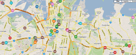
Ideally we would have everything graphically displayed on a map, with real time information on where all the buses are, where they are going and how long they will take to get there (as discussed by Jarrett Walker over at his Human Transit blog). That looks something like this:

Real time bus locations

Buses in inner city Sydney, as shown on a map

Cityrail Challenge

Posted: August 18, 2011 in Personal
Tags:

A few weeks ago I attempted the Cityrail Challenge – to go to every station on the suburban Cityrail network within 24 hours using only trains. This meant being on a train that actually stopped at these stations. I used the network bound by Waterfall, Macarthur, Emu Plains and Berowra, which meant 176 stations all up.

A video montage of photos taken at every station is included below.

For the individual photos, go to Picasa.

Some things I learned from that day:

  • While most of the Cityrail network is dual track  and some quad track, the Carlingford Line and the Richmond Line past Quakers Hill are still single track. For Carlingford this means hourly services. In Richmond’s case, it is able to provide half hourly services by having 2 platforms at certain stations and making trains wait until they are both at the same station before continuing, thus allowing them to leap frog each other in opposite directions.
  • There are a number of level crossings, most of them on the Richmond line.
  • You can still find some of the old wooden block timetables at some stations. Quite a few are on the Carlingford Line.
  • Guards don’t like it when you jump off at each station to have your photo taken and then jump straight back on, particularly when there are no other passangers getting on or off. I learned this the hard way, and that’s why most photos taken after the Bankstown Line are with me inside the carriage, rather than on the platform.
  • Lidcombe  and Wolli Creek are the only stations where you can catch trains that go either North, South, East or West. Once the Southwest Rail Link opens, Glenfield will be added to this list.

Seeing as I have a strong interest in all things public transport, I’ve decided to start up a blog on the topic. I’m hoping to focus on public transport in Sydney, the issues, the ides, my opinions, the news, etc.

I’ve lived in Sydney for over 20 years now, most of it in Toongabbie and Baulkham Hills, but I now live in Randwick. I’ve used a good mix of trains and buses during that time to get around, and have a pretty good working knowledge of transport around Western Sydney, the Hills and the Eastern Suburbs as a result.

Right now I’m paying most attention to the Northwest Rail Link and Randwick Light Rail projects – so I’ll probably talk about them the most, especially when they are in the news. But I’ll also try to keep things fairly broad.

My plan is to make 1-2 blog posts a week.